
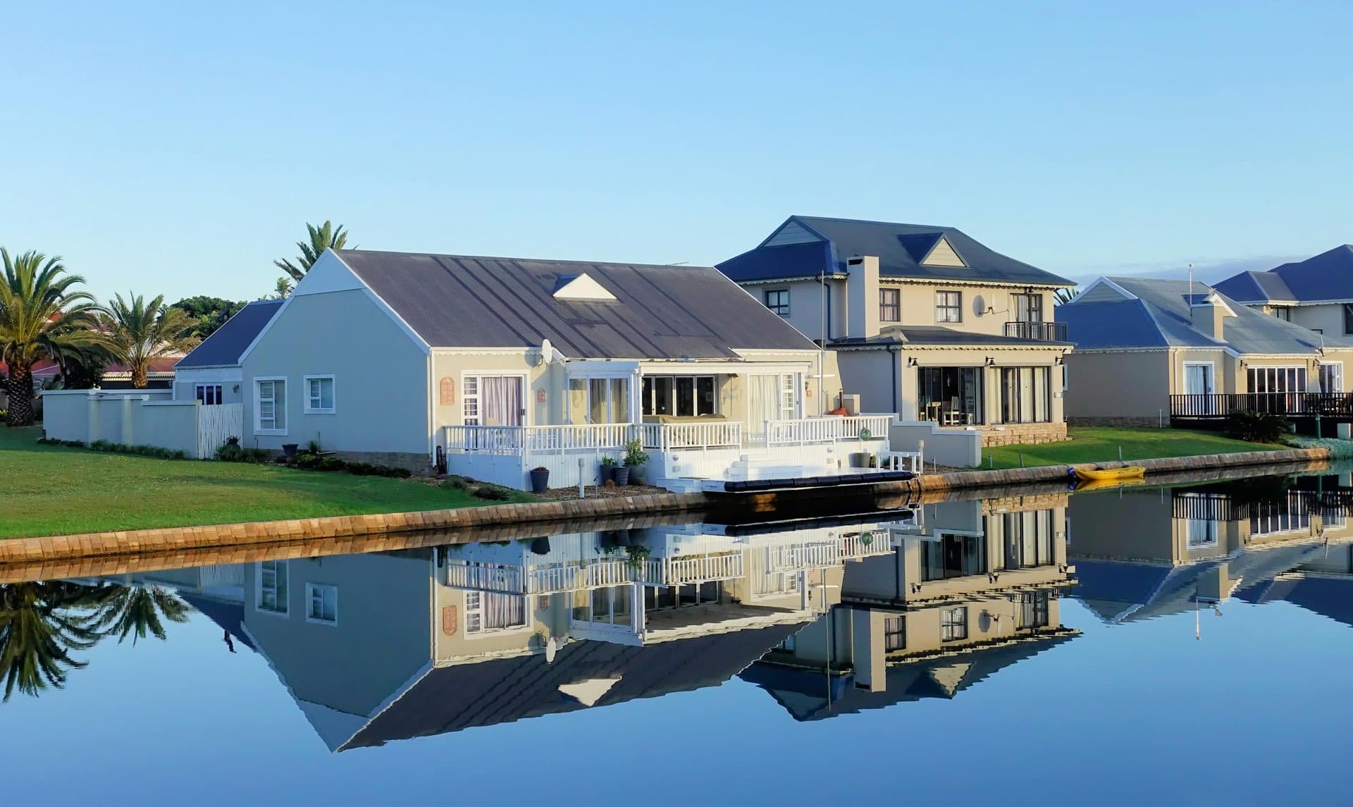
A photograph of a villa with a pool taken from the garden never shows its main advantage: the entire plot. An aerial view, on the other hand, reveals in a single shot the size of the land, the positioning of the pool relative to the house, the proximity of neighbors, and the immediate surroundings — information that can turn a simple viewing into an offer.
Real estate drone photography has established itself in just a few years as a genuine marketing tool, on par with HDR photography or virtual home staging. However, its use is still regulated by strict rules, costs vary significantly depending on the service, and poorly exploited aerial shots can do more harm than good to a listing. This guide details what a drone truly adds, the legal framework to follow in 2026, its costs, and how to leverage it in your published listing.
What you will learn in this guide:
- What an aerial view shows that ground photos cannot
- The real estate drone regulations in France in 2026 (DGAC, altitude, permits)
- Which properties truly benefit from aerial photography
- The cost of drone services, whether internal or with a professional pilot
- Best practices for capturing images and common pitfalls
- How to incorporate drone visuals into an AI-optimized listing
Why drone technology is a game changer in selling real estate
Ground photos depict a room. An aerial view tells the story of a property: the house’s placement on the lot, the true surface area of the terrain, proximity to access routes, neighbors, and the condition of the roof. Neither wide-angle nor HDR photos can convey this information from the ground level.
This information has a measurable effect on buyer engagement. According to data from the NAR (National Association of Realtors), listings enriched with aerial views generate up to 94% more views than those with standard photos, and typically sell 68% faster. This aligns with what French professionals observe: listings featuring video or drone photos tend to attract significantly more attention, especially for properties with large or remarkable outdoor spaces.
What an aerial view shows — and what ground photos cannot
- The actual size and shape of the land, often underestimated on cadastral maps or simple descriptions.
- The layout of the pool, added building, or garden in relation to the main house.
- The immediate environment: neighbors, roads, green spaces, unobstructed views.
- The condition of the roof, a frequent concern at visits that ground photos don’t always cover.
Real estate drone regulations in France in 2026
Flying commercially over a property isn’t improvised. European regulation EASA, transposed into France by the DGAC (Direction générale de l'aviation civile), classifies operations into three risk-based categories: open (low risk, leisure use and simple flights), specific (moderate risk, requiring authorization), and certified (high risk, tightly regulated, similar to manned aviation). Nearly all real estate footage falls under the specific category via the standard scenario STS-01: visual line of sight flight by the pilot, authorized even in urban areas under certain conditions.
Three obligations apply to any commercial drone flight:
- Pilot’s certificate, issued after passing the CATS — the State theoretical exam (about forty multiple-choice questions, minimum score of 75%) that replaced the CATT after December 31, 2025.
- Drone registration with the DGAC, mandatory for any device over 250 grams.
- Liability insurance covering specifically the professional use of the drone.
Flight altitude is limited to 120 meters above ground, which is more than enough to get an overview of the property. Flying over gatherings of people or in sensitive areas (near airports, classified sites) also requires DGAC authorization, sometimes also at the departmental level.
Privacy and neighbor considerations: often overlooked points
Overflights that inadvertently capture a neighbor’s garden or interior raise privacy issues and could lead to legal risks under GDPR. The sensible rule: pilot the drone only over the property in question, and blur or crop any images that might include third-party property or private areas in post-production.
Self-training or hiring a professional pilot
Agents or agencies have two options:
- Internal training: CATS certification and buying a professional drone involve upfront investment but pay off quickly for agencies handling multiple properties with land or outdoor space regularly.
- Hiring an independent pilot: the most common solution for occasional use, with costs including the service fee and regulatory compliance (certification, insurance, permits).
Which properties truly benefit from aerial shots?
Drone photography isn’t relevant for every listing. It is most beneficial for:
| Property Type | Drone’s Value |
|---|---|
| House with land | Actual land size and layout of the lot |
| Villa with pool | Single shot showing pool, house, and garden layout |
| Prestige property | Visual standard expected in this segment; see our guide to home staging for luxury properties |
| Building land | Configuration, access, immediate environment |
| New development | Overview of the project and its integration into the urban fabric |
| Condominium apartment | Little to no benefit unless there’s an exceptional view from a high floor |
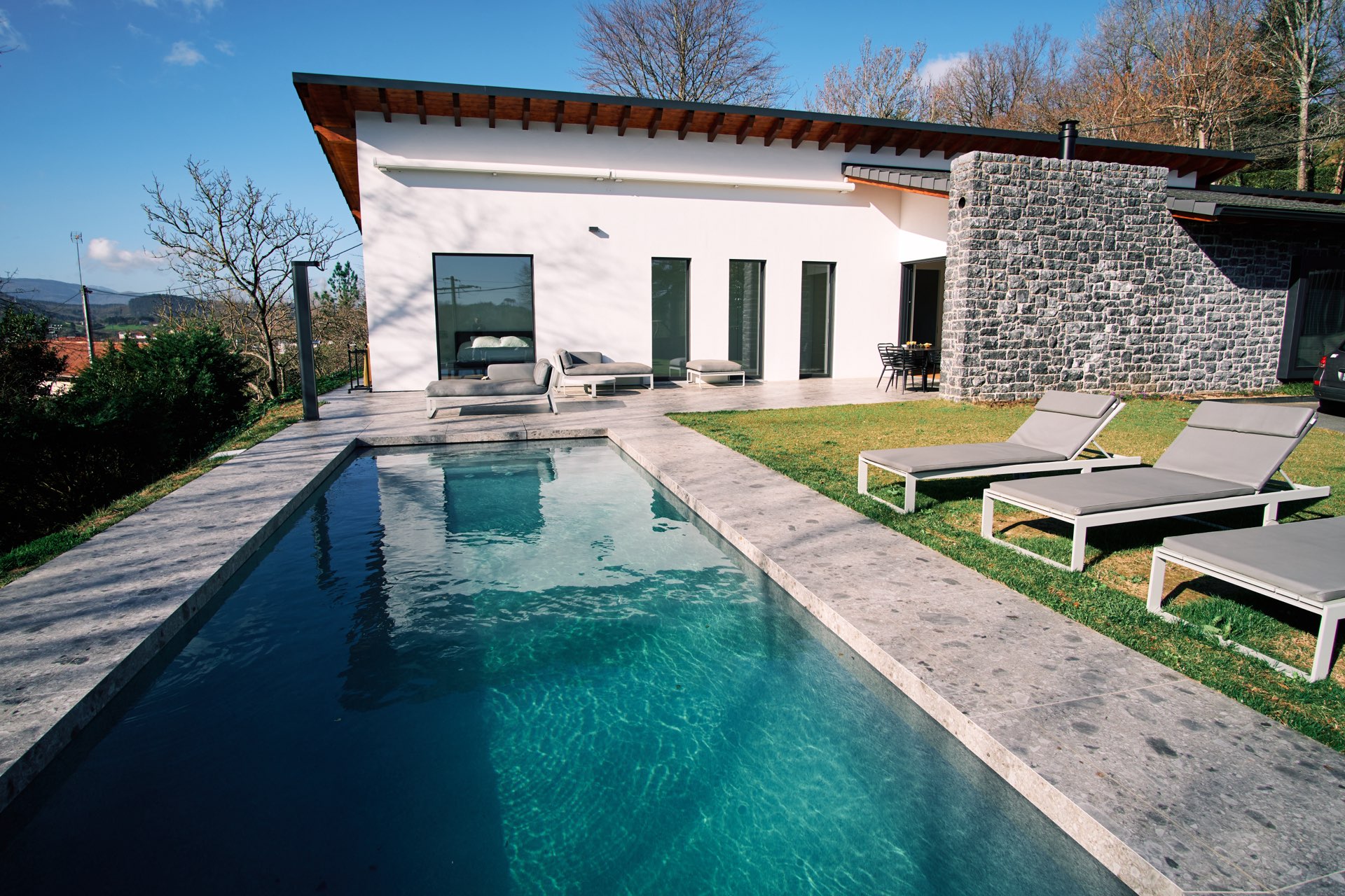 An aerial shot reveals in one image the pool, garden, and house layout
How much does a real estate drone service cost?
Prices vary depending on the service complexity, the restrictions in the area (regulated zones, airport proximity), and the number of properties covered.
| Service | Price Range |
|---|---|
| Standalone drone photo package | 80 – 200 € |
| Photo + aerial video (60-90 seconds) | 250 – 500 € |
| Aerial virtual tour + ground photos | 400 – 800 € |
| Agency subscription (weekly flight, multiple properties) | 800 – 2,000 € / month |
These rates generally include capturing footage and basic processing. Travel fees and advanced retouching are usually extra; clarify these details before commissioning the service.
Tips for successful drone shots: best practices
The right timing
As with all real estate photos, lighting is crucial. Our guide on lighting in real estate photography applies equally to drone images: prefer times when the sun is low (morning or late afternoon) to avoid harsh shadows and backlighting that flatten terrain relief from above.
Correct height and angle
- 30 to 50 meters usually suffice for a clear overview—no need to fly at the maximum 120 meters altitude.
- A 45° angle offers better depth perception than a strictly vertical shot, which flattens volumes.
- Steady, slow trajectories produce sharp images and professional-looking videos.
Coordinate drone and ground photography
The best listings never rely solely on drone footage. Aerial views set the scene and provide context; ground photos highlight interior spaces. Our comprehensive guide to professional real estate photography details how to combine ground and aerial images effectively.
From raw footage to a converting listing
Raw drone photos rarely leave the drone as-is: washed-out skies, yellowed lawns, faded facades from a distance. Post-processing happens in two stages.
Technical correction: exposure, contrast, and sometimes replacing the sky, similar to any optimized real estate photo edited by IACrea’s AI photo app.
Exterior enhancement: the outdoor enhancement feature from IACrea uses AI to retouch tired lawns, gray skies, or worn facades directly on aerial shots — no re-shoots or external photo editing software needed.
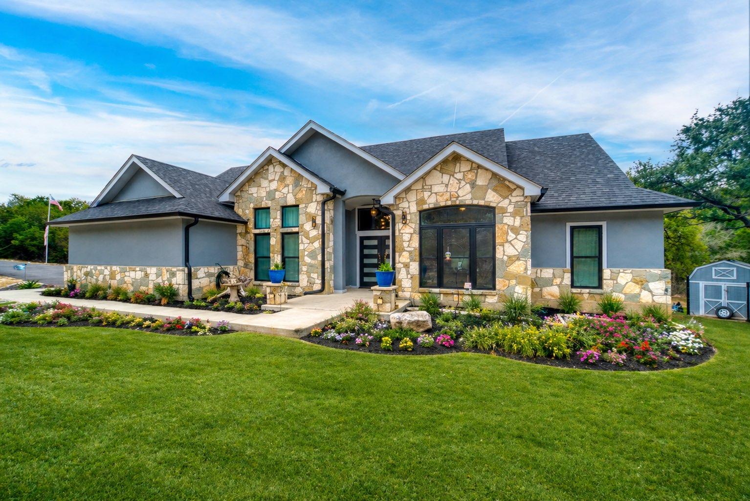 An exterior retouched by AI: lawn and sky made more attractive from the same shot
Interior views accompanying the aerial footage benefit from virtual staging: virtually furnishing or transforming a vacant or dated space for a coherent look with the spectacular drone perspective. Check the offer options and prices to include this enhancement in your workflow.
Common mistakes to avoid with real estate drone photography
- Flying without certification or insurance: beyond fines, an incident without coverage directly engages the agent’s or agency’s liability.
- Framing too wide, capturing neighbors: easily avoided by adjusting the flight path or cropping in post.
- Publishing unretouched aerial images: washed-out sky or dull grass look neglectful and undermine your marketing effort.
- Relying solely on drone images: an all-aerial listing doesn’t reassure about interior conditions — both formats should complement each other.
- Ignoring weather conditions: overcast skies or strong winds seriously impair image quality and stability, even for skilled pilots.
FAQ
Do I need a permit for real estate drone photography?
Yes. Any commercial flight requires a pilot’s license — obtained after passing the CATS theoretical exam, with the drone registered with the DGAC, and possessing a specific liability insurance. Most real estate shots are covered under the standard scenario STS-01, which allows visual line of sight flights, including in urban areas.
What is the maximum permitted altitude for a real estate drone?
120 meters above ground, consistent with European EASA regulations adopted by the DGAC. This height is sufficient to capture an overall view of a property and its surroundings.
What’s the typical cost for drone photography of a property?
A standalone package usually costs between 80 and 200 €, while combining photos and a 60-90 second video ranges from 250 to 500 €. Agencies using a pilot regularly often negotiate monthly subscriptions between 800 and 2,000 €, based on weekly visits.
Can I fly over a neighbor’s property with my drone?
Not without precautions. Overflight should only capture the property in question. Clear images of third parties, their garden or interior raise privacy and GDPR concerns. Over flights over inhabited zones or gatherings require DGAC permission and, depending on local rules, possibly a permit from local authorities.
Is drone photography useful for all property types?
No. It’s most effective for houses with land, properties with pools, luxury estates, building plots, and new developments, where it reveals information that ground photos can’t. For an apartment in a condo without noteworthy outdoor space, investment in drone imagery typically offers little added value.
How to integrate drone photos into an AI-optimized listing?
Raw drone images are edited like any real estate photo: exposure correction, sky replacement, then external improvements (lawn, facade, pool) using IA tools from IACrea before adding them alongside HDR photos and virtual staging if needed.
Conclusion
Real estate drones aren’t just gadgets: for properties with outdoor space, pools, or upscale features, they reveal details impossible to see from the ground and significantly boost engagement. Yet, regulation (certification, insurance, altitude, neighbor respect) and costs must be carefully managed. Once captured, the key lies in processing: IACrea’s AI photo app and outdoor enhancement transform raw aerial footage into compelling visuals that encourage clicks and visits.
About the author

Co-founder & CEO of IACrea
Pauline Clavelloux is co-founder and CEO of IACrea. In daily contact with real estate agencies and agents, she understands their challenges around visibility, marketing and lead generation. On the blog, she shares actionable strategies on real estate marketing, social media and prospecting in the age of AI.
Related articles
Ready to turn your photos into content that sells?
Join thousands of real estate agents using IACrea to create professional content in seconds.
Try for free →